Well, what does one do when eaten up by the daily dramas of civillized lifestyle? We've all been nomands at heart and sometimes that urge can seldom be cured gazing at pixels of modern eyes. To find enlightenment, to relax, to get away from the hustle bustle, to meditate with the Lord, or even to take a new facebook profile picture to flaunt infront of your buddies....the call of the mountains is irresistible.
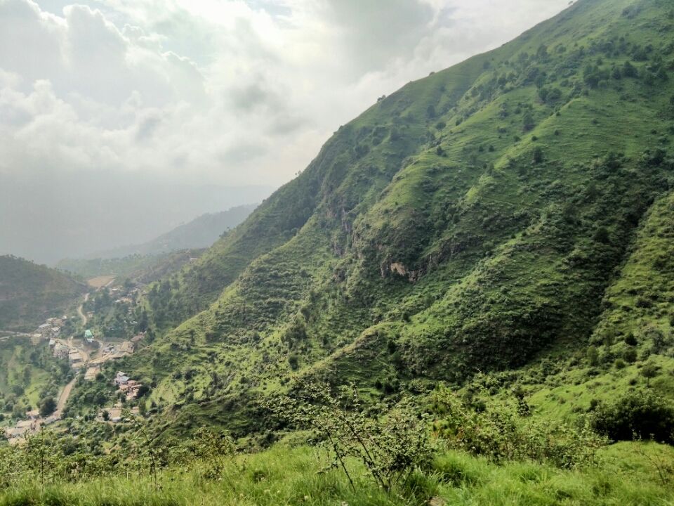
This log is about my trip to a mountain, just behind my house. Being a local of Himachal Pradesh (shimla & solan) and having forever resided in the hills I know it's magic. This is not a very well discovered area but it is 2 hour trek to the top. Total walking distance covered one way to the peak was 8.7km (via Basal), so get your boots on. It is the second highest peak of Solan district (Himachal Pradesh) after Chail which lies just 50m higher than it's peak.
The trek is a beautiful option to undertake on weekends, especially for the locals. One can easily take a bus from Shimla (2 hours) or Rajgarh (2 hours) or even Chandigarh (1 and half to 2 hours) to Chambhaghat to reach the starting point of this trek. It is an easy to very easy trek, only proving to be a little harsh on your knees if you've been a corporate slave for years or biding time living a sedentary lifestyle.
But don't worry though, there will be a point after which you won't feel a thing. Basically above green patch you would have sweated alot, and now anything more would just be a cakewalk. Um, speaking of cakewalk...there are wild cows/buffalos grazing on the green patch, try not to step on their cake or make them angry. The locals are far down, only to return late evening to gather their livestock.
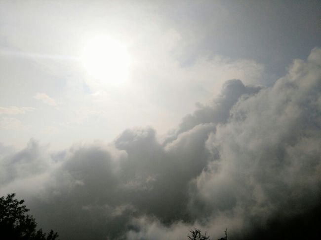
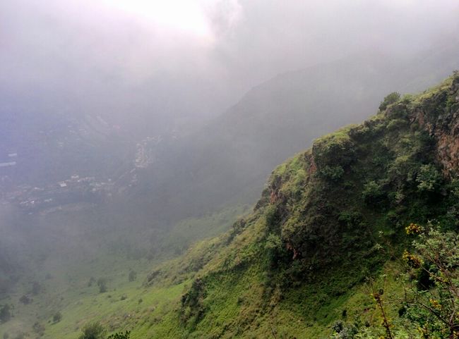
But the clouds, just get closer.
There are many ways to tackle this trek, all lead to the green patch which can be taken as base point -
1) One can go through Kandaghat, which is long route. It has a big frog statue and a small but photogenic waterfall. (I have not undertaken this path till yet so can't say much.)
2) Second one goes up from Chambhaghat itself. If you are a sucker for walks take this one, it shall satisfy your crave. Not much in for the views though until you reach the green patch.
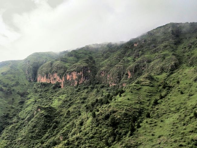
3) Third goes from up Jhairash (a village on mount Karol), pretty scenic to walk through the terrace farming especially in winter when light snow can be found upto some extent.
4) Lastly but not the least, this trek can also be undertaken climbing up from Basal village, situated at 2km away from Chambhaghat (there is a diversion going upwards beside the busstop, take that to reach here). You will see a Peepal-tree, just start climbing from up there rest is pretty self explanatory.
Pick your poison.
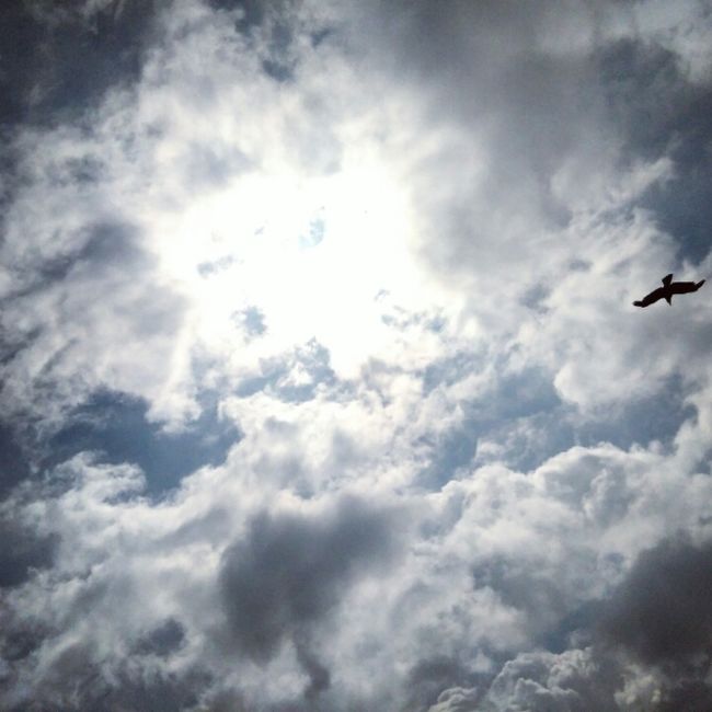
Here's some motivation
Now, the 4th way (the way which I took) is pretty quick. And a fit person can reach the green patch from about here in 45 minutes. It is a moderately steep climb although with many shortcuts to cut the time. See how many you can find. Although do not hurry, it is a beautiful trek up ahead no matter how the start feels like.
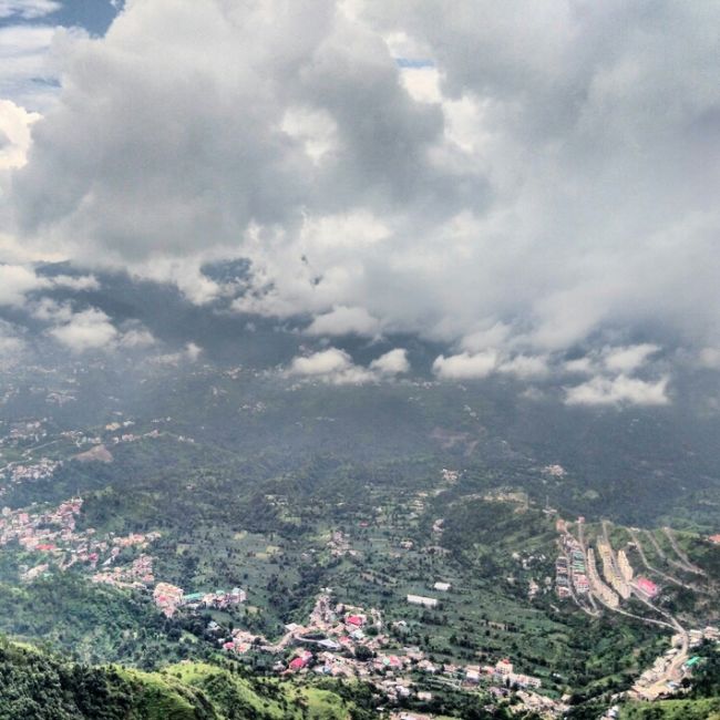
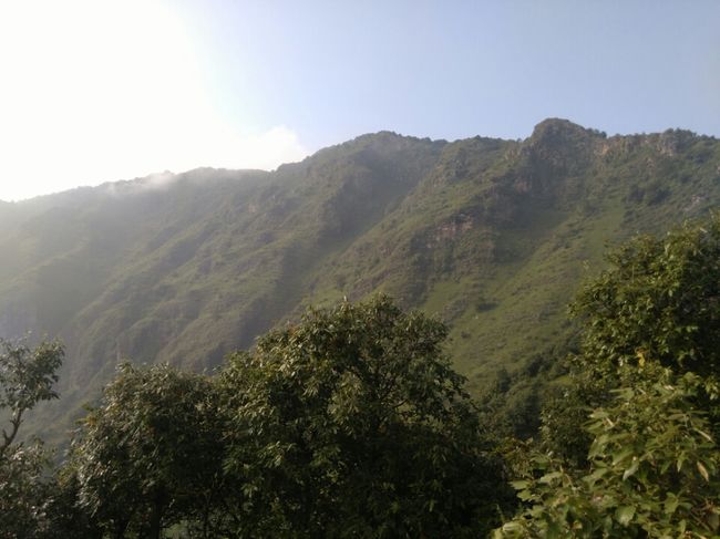
As you ascend height upwards, the place turns out to be getting more and more photogenic. Good spots are plenty for envious profile picture uploads. Keeping moving upwards, stopping at a few points for food (if you are hungry) although I reccomend to endure the struggle and wait for the green patch.
We were used to the terrain and the trek so barely took any breaks except for water and a few clicks.
Lo and behold -
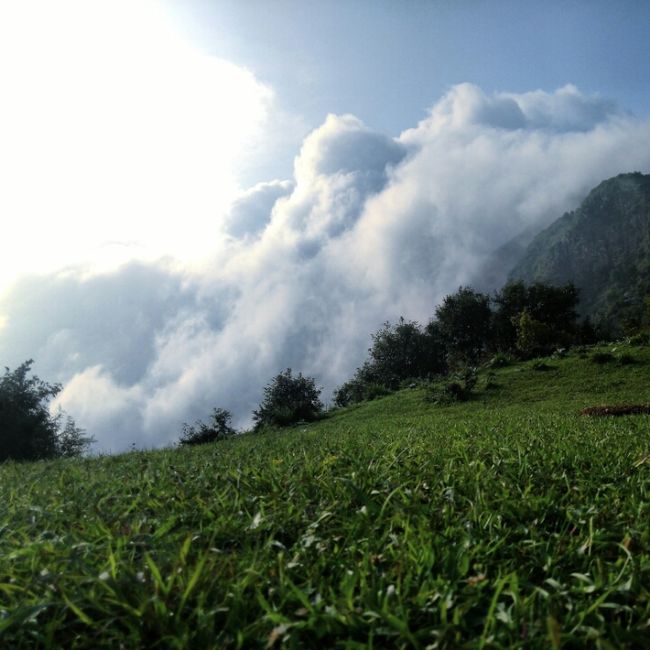
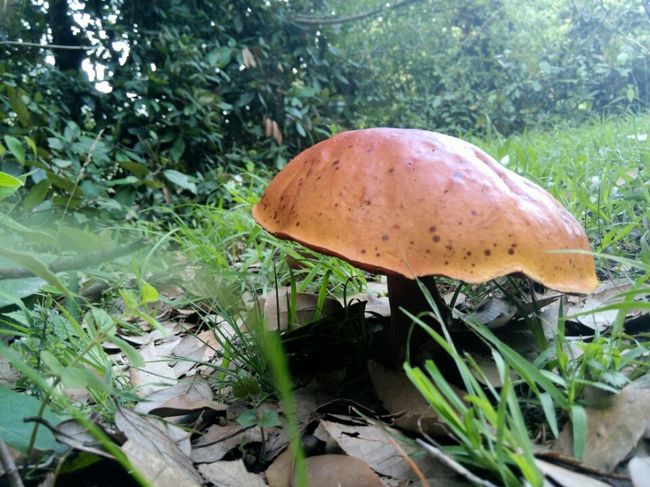
As the captivating sight of green patch engulfs you, feel free to just lie down and relax or have a nice picnic in the lap of nature. Your struggles have been worth it. There is a pond to be found here which is said to freeze in winter along with many berries, a home, some horses and cows, mushrooms and the likes. A photographer will feel the potential gurgling though this place.
Mushroom city of India, what else do you expect?
Now here's when you choose where you go.
You can either go and follow the path which says 'Rasta Karol' (way to Karol) and reach the temple cutting through dense forests...
OR
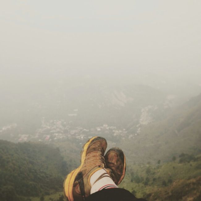
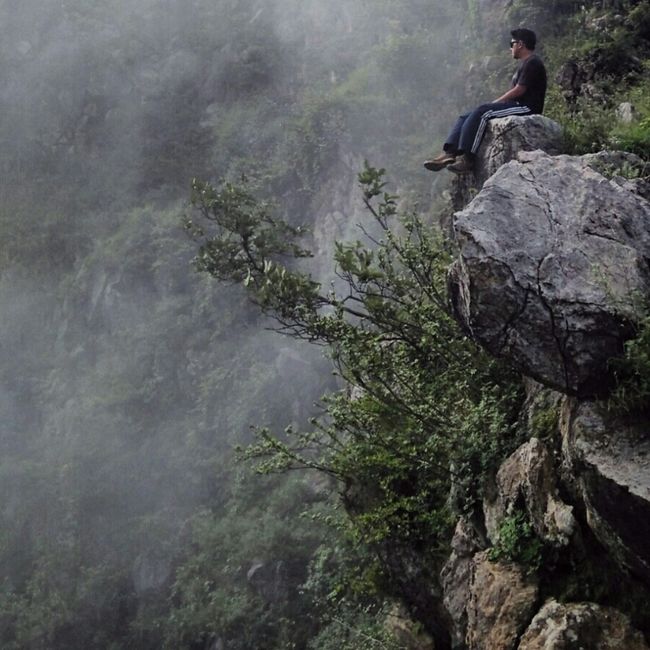
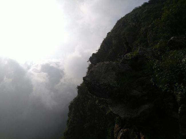
You can climb up from the left of the sign, and get engulfed by views, edges, clouds below your feet etc.
Again, it's your call.
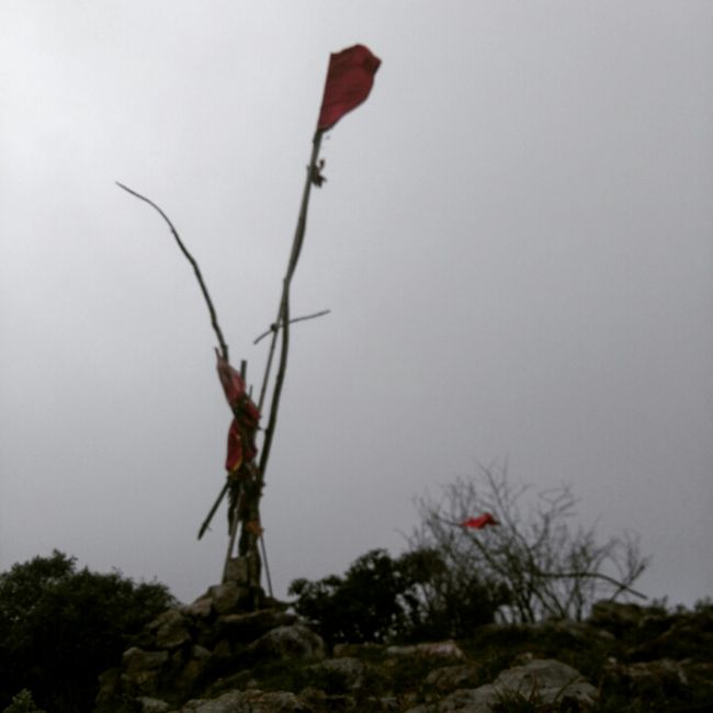
No matter which path you choose you will eventually reach the peak, marked with a flag. There are many spots to be photographed here so take your time to capture the real beauty. Please do not litter anywhere on the mountain and keep it's sacred nature intact for many more to come. Beware if you choose the one less travelled, like I said it is upto you to make your path. If unsure DO NOT undertake this path.
The peak is exactly 2250m above sea level, and the path taken by me had 8.7km of one way walking as stated earlier.
That's it! You have conquered the Pandavan Cave Trek (Karol Trek) . Congrats!
The cave is no more functional due to rock slides as of now. Legend says Pandavas used it to travel, and that it leads upto Parwanoo but I'm not a very religious person but spiritual instead so not interested in it.
You can now either go back from the path you made, or find a path sliding straight into the forest. Be careful while sliding it is usually algae and muddy waters in the monsoon season. Pick whatever suits you and save some last clicks.
Now with your battery dwindling and stamina crashing. Have a nice walk down listening music down the mountain from the green patch. Resting afew times to admire the beautiful sunset. The nights sleep you get today will be one of your most blissful for the mountains have now blessed you. And not to mention how badass your instagram/facebook feed will be!
Happy travelling
& Keep the wanderlust alive!
- Mayank Pathak